When you click on links to various merchants on this site and make a purchase, this can result in this site earning a commission. Affiliate programs and affiliations include, but are not limited to, the eBay Partner Network.
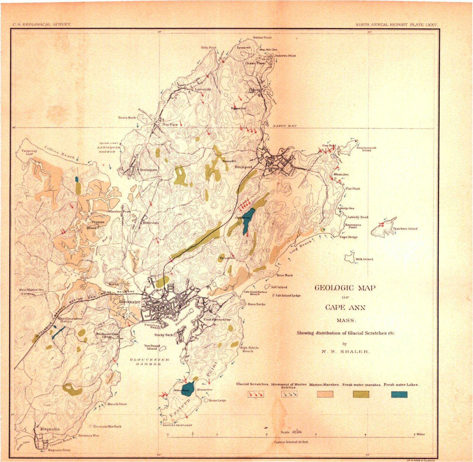
Title: Geologic Map of Cape Ann, Massachusetts – 1889 U.S. Geological Survey PlateStyle: 19th‑Century American Scientific Map – Government Geological EngravingSource: Ninth Annual Report of the United States Geological Survey to the Secretary of the Interior, 1887–’88Published: Washington, Government Printing Office, 1889Cartographer / Geologist: N. S. ShalerDirector: J. W. PowellTechnique: Lithographed Geological Map with Color OverlaysLanguage: EnglishSize: Approx. 11 × 11.25 inchesCondition: Very good — note age/browning left side, stain bottom border
DescriptionThis authentic 19th‑century geological map shows Cape Ann, Massachusetts, detailing glacial scratches, moraines, and fresh‑water lake deposits.• Plate XXXV from the Ninth Annual Report of the U.S. Geological Survey• Engraved and printed by the Government Printing Office under J. W. Powell’s direction• Includes Gloucester Harbor, Sandy Bay, and surrounding coastal features• Ideal for collectors of U.S. Geological Survey material, Powell reports, and 19th‑century scientific cartography
Historical ContextThe Ninth Annual Report (1887–1888) under Director J. W. Powell marked a major expansion of the U.S. Geological Survey’s mapping program, combining field geology with topographic precision. N. S. Shaler’s Cape Ann study documented glacial formations and coastal geomorphology, contributing to early American understanding of Pleistocene geology.This map exemplifies the Survey’s transition from purely descriptive geology to systematic mapping, making it a cornerstone in U.S. scientific publishing history.
Shipping & GuaranteeThis is an antique 1889 map — not a reproduction.Shrink‑wrapped on acid‑free backing and mailed flat.30‑day return policy for any reason.
KeywordsCape Ann; Massachusetts; USGS; Geological Survey; Powell; Shaler; 19th‑century map; glacial geology; Government Printing Office; antique map.