When you click on links to various merchants on this site and make a purchase, this can result in this site earning a commission. Affiliate programs and affiliations include, but are not limited to, the eBay Partner Network.
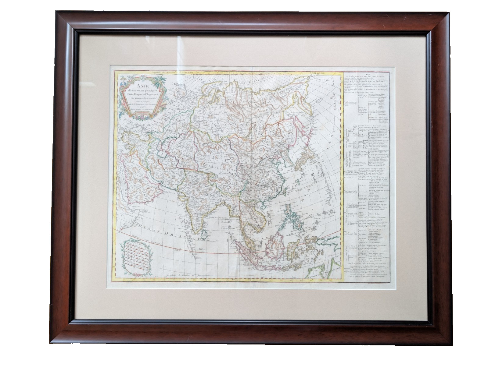
Antique hand-colored copper engraved map of Asia, titled \"Asie divisée en ses principaux Etats, Empires & Royaumes,\" by Robert de Vaugondy, revised and corrected by C.F. Delamarche, published in Paris. This example is the updated state (circa 1800) of the original 1791 plate, incorporating La Pérouse\'s discoveries north of Japan and additional detail along northern Australia and the Torres Strait.
The map spans from Turkey and the Middle East across Russia and the Tartaries (Tibet labeled \"Etat du Delai Lama\") to the Bering Strait, Japan, and Southeast Asia, with an extensive geographical reference table along the right margin. Hand-colored in outline with decorative title cartouche.
Map size: 26\" x 19.7\" | Framed size: 31\" x 36\" (double-matted, wood frame with glass)
Provenance: Previously sold through Old World sales (Lot #446); sale documentation with full cataloging details, condition notes, and reference citation (cf. Yeo #207) included with sale.
Condition: Per prior sale cataloging — faint foxing and damp staining confined to blank margins, tissue repair to a short separation at the bottom centerfold. Rated condition \"A\" at that time (see documented sale material).
Note on Frame: I am listing as professionally framed in very nice dark hardwood frame and local pick up is preferred. I offer the option to remove from frame and ship in original map at buyer\'s preference or to help coordinate shipping as framed for serious buyers. Please message us for questions.