When you click on links to various merchants on this site and make a purchase, this can result in this site earning a commission. Affiliate programs and affiliations include, but are not limited to, the eBay Partner Network.
A complete example of RUSSELL\'S MAP OF THE ENVIRONS OF LONDON, WITH A GUIDE — an original hand-coloured folding map, its companion pocket guidebook, and the original cloth case they came housed in, all surviving together as issued.
The map itself is titled \"The Pedestrian\'s Companion. Fifteen Miles Round London\", engraved by S.I. Russell and published by Edward Grattan of 51 Paternoster Row, London, with the imprint \"London, Published by E. Grattan, 51 Paternoster Row, July 3, 1838\" along the lower edge. It is dissected into sections and mounted on linen in the standard manner for a traveller\'s pocket map of the period, so that it folds compactly into its case. The map is recorded in Howgego\'s standard bibliography of London maps, \"Printed Maps of London circa 1553–1850\", as reference no. 360a.
Centred on St Paul\'s, the map covers a full fifteen-mile radius around London, with the county boundaries of Middlesex, Surrey, Kent, Essex and Hertfordshire picked out in original hand colour, and extends as far as Uxbridge, Waltham Abbey, Romford, Epsom and the roads toward Reigate and Maidstone. It captures the capital at a fascinating moment: villages such as Streatham, Clapham and Harrow-on-the-Hill are shown as distinct settlements in open countryside, well before the suburban growth of the Victorian era absorbed them, while a \"Railway\" is already marked running down through Purley toward Croydon — this part of Surrey was served from 1803 by the pioneering horse-drawn Surrey Iron Railway, one of the world\'s earliest public railways, right as the steam-hauled London & Croydon Railway was itself under construction nearby (it opened in 1839). The map is filled with practical detail for the traveller of the day: tables of coach and carrier fares, watermen\'s fares for Thames boats from London Bridge, lists of fair and market days in the surrounding towns, distances measured from London Bridge, Westminster Bridge and Whitechapel Church, and a key (\"Explanation of Signs\") for gentlemen\'s seats, parks, woods, commons, marshes and the newly-marked railroad.
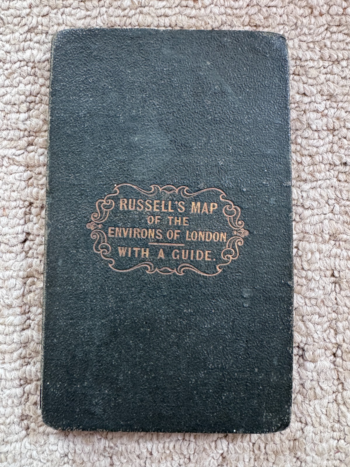
The companion volume is \"A Guide to the Environs of London; Being a Sequel to Russell\'s Map\" by James Gilbert, also published by E. Grattan, London, and evidently intended to be read alongside the map. The date \"1838\" is pencilled to the title page and front paste-down, presumably by an early owner, matching the map\'s own imprint date. Both pieces are housed together in their original dark green cloth case, gilt-titled \"RUSSELL\'S MAP OF THE ENVIRONS OF LONDON WITH A GUIDE\" to the front board.
Condition: the map itself is bright, with vivid original hand colour, and remains complete on its linen backing with only minor separation at a couple of the panel folds (see photographs). The cloth case shows genuine handling wear consistent with its age — rubbing and light soiling to the boards, and some cracking to the spine and inner hinge, visible where the guide book is shown open — while the gilt titling remains clear and legible. The guide book has wear and some splitting to its spine and browning to the endpapers, but the text block is complete and legible throughout. A complete matching set like this — map, case and guide surviving together as issued — doesn\'t come up as often as the map alone, since the two are frequently separated over time. Sold exactly as photographed; more close-up photographs are available on request.
Measures 6.5 inches by 4 inches when folded closed.
The map measures 25 inches by 18.75 inches when unfolded.
Please see pictures as this will help you to ascertain the content and condition of this item. The pictures show the item you will receive. If there is a small \"Original\" tag on any of the pictures, this is purely to stop copying of the photographs; this tag is not affixed to the item and is not there to hide any damage.
PLEASE NOTE: Shipping charges are now set by \'s \"Simple Delivery\" programme. I have no control over these charges.
BUYING MORE THAN ONE ITEM FROM ME: Please place items into your basket and then Checkout. will calculate a combined shipping amount for you. I\'m afraid I have no control over this now I HAVE to use the \"Simple Delivery\" programme. If you buy one item from me and then see something else you would like to buy, I CANNOT combine shipping as will provide me with a shipping label for each item, and then use these to track the delivery.
I only post overseas using the Global Shipping Programme - please do not ask if I can send this item overseas via Royal Mail, as the answer will be \"No\". I am sorry that the GSP is so expensive for buyers, but it offers sellers such as myself much more protection should the item go missing on its journey to you. Royal Mail will only pay out on a missing item if I can provide them with an originalreceipt, and will only pay out what I PAID for the item, not what I sold it for. For the majority of my items, which I have bought myself over 40 years of collecting, I certainly do not have an original receipt!!
I am very proud of my response and offer a full money-back guarantee should you not be satisfied with anything you buy from me. If you have any comments, problems or issues about your item, please message me, I\'m sure we can work out a solution. You can see from my response that I am an honest seller with a desire to ensure that all my customers are happy.
Please feel free to ask any questions.
2W