When you click on links to various merchants on this site and make a purchase, this can result in this site earning a commission. Affiliate programs and affiliations include, but are not limited to, the eBay Partner Network.
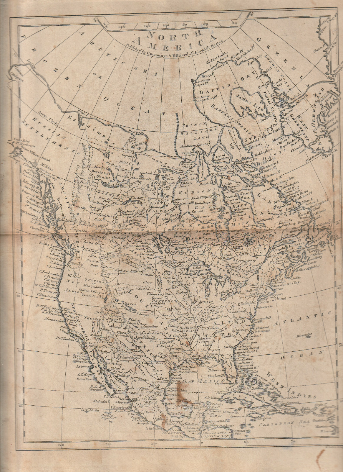
SCHOOL ATLAS TO CUMMING\'S ANCIENT & MODERN GEOGRAPHY - 8 MAPS Circa 1813-1821
This booklet has 8 fold out maps, no title page or other information.Maps were printed by Cummings and Hilliard, Boston, Mass.
8 maps:World, North America, US of America, South America, Europe, Britain of the United Kingdom of England & Scotland & Ireland, Asia and Africa.maps fold out and are 11\"l x 9\"wVERY GOOD SOFTCOVER
10\"l x 6\"wWeight: 4 oz.