When you click on links to various merchants on this site and make a purchase, this can result in this site earning a commission. Affiliate programs and affiliations include, but are not limited to, the eBay Partner Network.
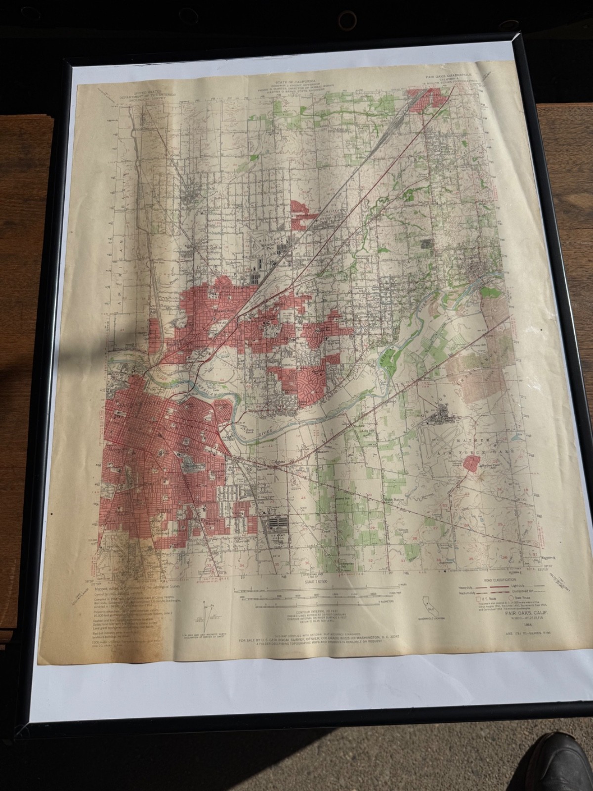
Vintage 1965 USGS Fair Oaks Sacramento CA 1954 Edition 15-Min Topo Map.
Condition:
Original vintage map in good displayable condition. Noticeable age toning, surface waviness, fold/roll creases, scattered marks, edge wear, and small creases or tears along the upper margin. Printed information and map details remain clear. Please review all photographs for exact condition.
Description:
Original vintage USGS Fair Oaks Quadrangle topographic map covering Sacramento, North Sacramento, Fair Oaks, Carmichael, Citrus Heights, Roseville, McClellan Field, Mather Air Force Base, the American River, and surrounding communities.
The map is the 1954 Fair Oaks edition with a 1965 US Geological Survey printing code along the lower margin. It was compiled in 1954 and provides a detailed historical view of the Sacramento region during its rapid mid-century development.
Details include highways, railroads, airfields, military facilities, schools, waterways, neighborhoods, agricultural land, elevations, and former landmarks. Produced in cooperation with the State of California under Governor Goodwin J. Knight.
This is an authentic period government-printed map, not a newly manufactured decorative reproduction.
Frame:
The black display frame shown may be included if the framed option is purchased. Framed shipping costs more and carries additional transit risk. The unframed map will be carefully rolled or loosely folded according to its existing creases and securely packaged.
Buyer Protection:
The map shown is the exact item the buyer will receive. It will be carefully packed, photographed before shipment, and shipped with tracking. Any insured shipping claim requires the buyer to retain the item and all original packaging.
California Proposition 65:
WARNING: Vintage inks, paper treatments, adhesives, and frame materials may contain chemicals known to the State of California to cause cancer, birth defects, or other reproductive harm. Sold as a collectible display item.
Keywords:
Fair Oaks map, Sacramento map, vintage USGS map, 1954 California map, 1965 printing, 15 minute quadrangle, Roseville, Carmichael, Citrus Heights, American River, McClellan Field, Mather Air Force Base, historical California, topographical map