When you click on links to various merchants on this site and make a purchase, this can result in this site earning a commission. Affiliate programs and affiliations include, but are not limited to, the eBay Partner Network.
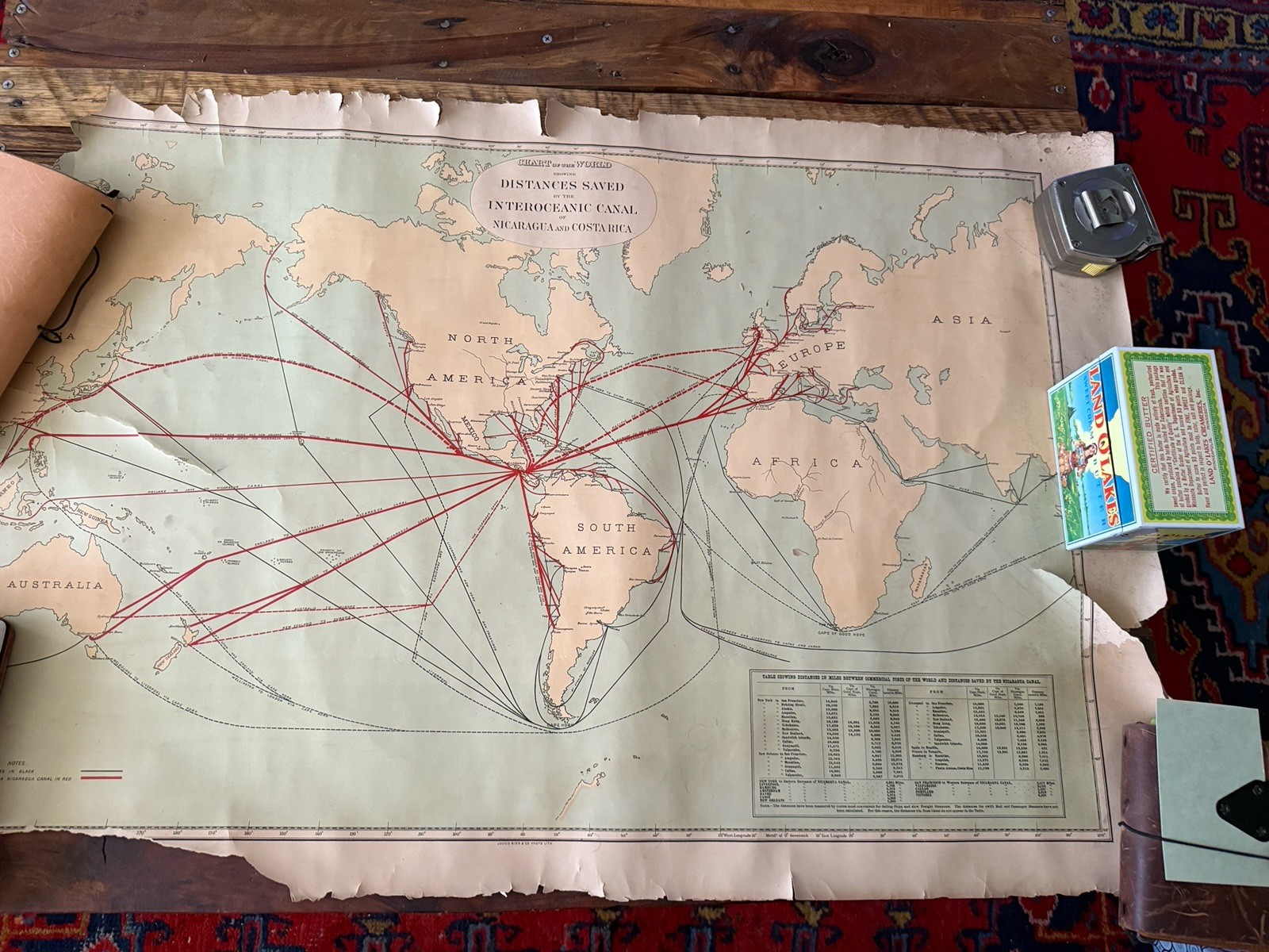
Antique chart of the world showing distances saved by the Interoceanic Canal of Nicaragua and Costa Rica. Large paper map measuring approximately 36 x 24 inches. This is an interesting old display piece with great eye appeal and nice detail throughout.
Please note the condition is poor and there is significant damage. There are numerous rips, tears, splits, edge tears, edge losses, creases, and worn areas throughout. The paper has become brittle with age and there are several damaged sections, including longer tears and separation along fold or stress areas. There is also curling, chipping, and general wear from age, storage, and handling.
This is being sold strictly as found, as shown, for display, study, or possible restoration. Please look closely at all photos because the damage, rips, tears, and overall fragile condition are a major part of the description. Again, there are multiple rips and tears throughout and the paper is brittle.
A scarce and unusual antique map for the collector of world maps, canal history, or transportation related paper items.