When you click on links to various merchants on this site and make a purchase, this can result in this site earning a commission. Affiliate programs and affiliations include, but are not limited to, the eBay Partner Network.
Each sheet 80 x 59.5 cm (31.5 x 23.5 in).
Venezia Tridentina / Venezia Giulia.
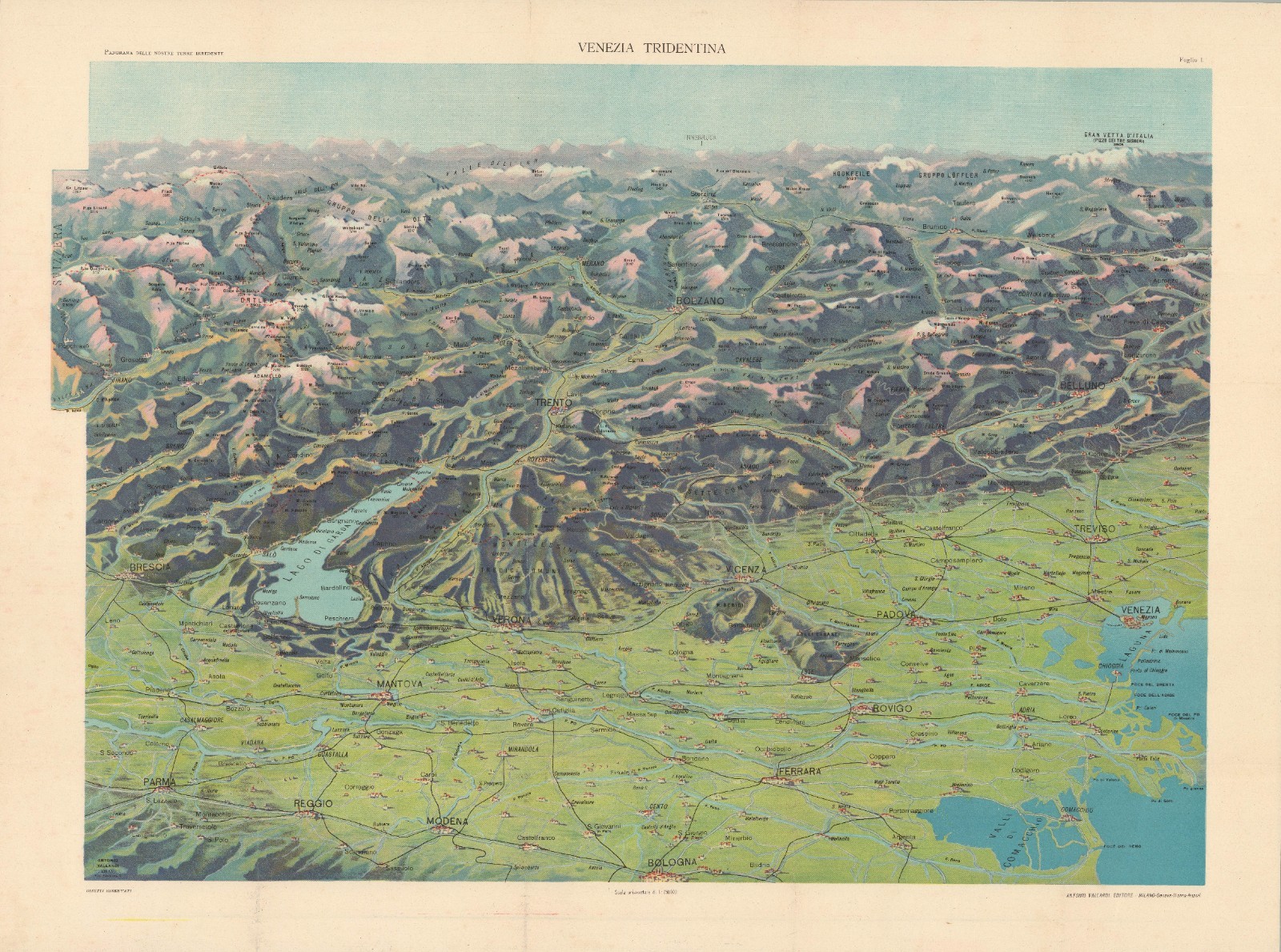
Published around 1910 by the prominent Milanese firm Antonio Vallardi Editore, this pair of chromolithographic bird\'s-eye views presents a dramatic, three-dimensional panorama of northeastern Italy and its northern alpine borderlands. Comprising individual sheets for Venezia Tridentina and Venezia Giulia, the cartography employs high-angle oblique perspectives, directional shading, and a rich color palette to illustrate regional relief.
In the Venezia Tridentina view, the lush green plains of the Po River valley—dotted with major urban hubs like Bologna, Ferrara, Parma, and Verona—sweep northward past the Venetian Lagoon and the basin of Lake Garda, carving up through the Adige River valley toward Trento, Bolzano, and the snow-capped central Alps. The companion Venezia Giulia sheet shifts focus to the northeastern Adriatic coastline, depicting the deep blue waters of the Gulf of Venice and Gulf of Trieste framing the triangular Istrian peninsula, with key ports like Trieste, Pola (Pula), and Fiume (Rijeka) giving way to the rugged karst plateaus and Julian Alps beyond.
Historically, these sheets embody the geopolitical framework of the Tre Venezie (\"Three Venetias\"), a cultural-geographic concept formulated in 1863 by the Italian linguist Graziadio Isaia Ascoli to delineate Venezia Euganea (the Veneto core), Venezia Tridentina (Trentino-Alto Adige), and Venezia Giulia (the Julian March and Istria). At the time of publication around 1910, while the Veneto proper had joined the Kingdom of Italy in 1866, both Venezia Tridentina and Venezia Giulia remained under the sovereignty of the Austro-Hungarian Empire. Consequently, these territories represented the primary focal points of Italian irredentism—the nationalist movement advocating for the annexation of Italian-speaking terre irredente (\"unredeemed lands\") still held by foreign powers prior to World War I.
Beyond their pedagogical function for schools and libraries, Vallardi’s panoramas served as subtle visual arguments for national unity and geographical cohesion. By rendering the topography with physical continuity—drawing an unbroken line from the fertile northern Italian lowlands to the Alpine crests and the Istrian littoral—the maps visually asserted that these border regions belonged naturally to the Italian geographic sphere. Following the collapse of Austria-Hungary at the end of World War I, the boundary adjustments codified in the Treaty of Saint-Germain-en-Laye (1919) and the Treaty of Rapallo (1920) ultimately brought these mapped landscapes under Italian rule, transforming these pre-war cartographic visions into political reality.
Only one example of this set of views is recorded in the OCLC, held by Stanford University.