When you click on links to various merchants on this site and make a purchase, this can result in this site earning a commission. Affiliate programs and affiliations include, but are not limited to, the eBay Partner Network.
26 x 20.75 in.
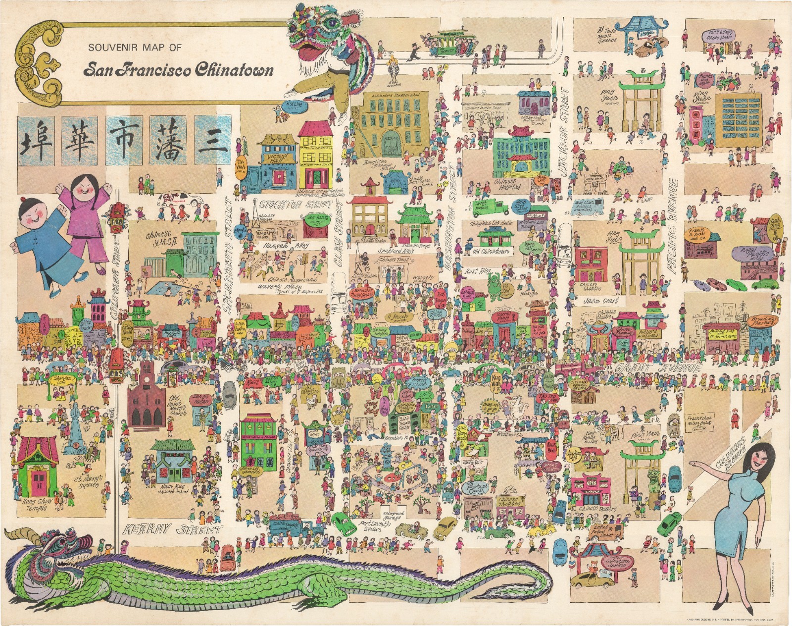
Souvenir Map of San Francisco Chinatown三藩市華埠.
This is an exceptional pictorial map of San Francisco’s Chinatown, dating to the Summer of Love, 1967. Oriented with West at the top, the map extends south-north from California St. to Broadway, and east-west from Kearny St. to Powell St.
With wonderful illustrations of local businesses and historic buildings, the illustrator creates a joyful atmosphere that promotes one of the most unique urban districts in all of the United States.
This is the oldest Chinatown in North America and the largest Chinese enclave outside Asia. It is also the oldest and largest of the four notable Chinese enclaves within San Francisco. Since its establishment in 1848, San Francisco's Chinatown has been highly important and influential in the history and culture of ethnic Chinese immigrants in North America and their descendants.
Only one recorded example, at Stanford University (OCLC1129598733). This map only occasionally comes to market.