When you click on links to various merchants on this site and make a purchase, this can result in this site earning a commission. Affiliate programs and affiliations include, but are not limited to, the eBay Partner Network.
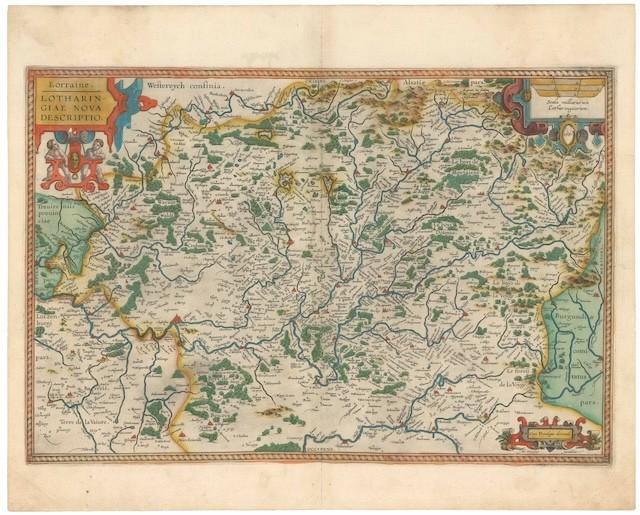
This lovely late 16th-century map depicts the Franco-German border region known as Lorraine. It was compiled by the renowned Flemish mapmaker Abraham Ortelius and issued in a later edition of his famous atlas: Theatrum Orbis Terrarum. The map is signed and dated 1587 in the plate (below the scale in the upper right corner). It is oriented with East at the top and centers on the Moselle River Valley and the great medieval cities of Nancy and Metz. The map is crisp with vibrant original coloring. Despite its diminutive size, the map has been adorned with tree decorative cartouches. We mentioned the scale bare cartouche in the upper left corner. Across from it is the map\'s title, cartouche. A smaller cartouche in the lower right corner highlights Ortelius\' royal privilege.
Context is EverythingFramed by the Rhine and Vosges Mountains, Alsace-Lorraine is a historical treasure, constituting the border region between France and Germany. It was at the heart of Charlemagne\'s Frankish Empire in the 9th century and, later, an integral part of the Germanic Holy Roman Empire. The area\'s history is a captivating narrative of control under various German sovereignties until it fell to France during the Thirty Years\' War (1618-48). Ortelius compiled this map shortly before this significant transition, adding to its historical allure.