When you click on links to various merchants on this site and make a purchase, this can result in this site earning a commission. Affiliate programs and affiliations include, but are not limited to, the eBay Partner Network.
Artscape GalleriesPosters from a Simpler Time . . . . .
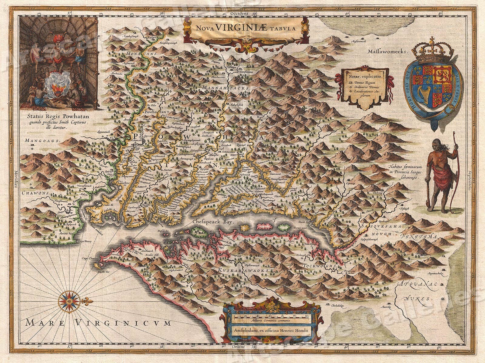
Store Categories Nova Virginiae Tabula - Map of the Virginia Colonies and the Chesapeake Year: 1630Size: 24"x32"
Oriented to the west, this map of the Virginia colony spans from CapeHenry to the Susquehanna River and as far inland as the AppalachianMountains (many of the mountain ranges shown do not exist). Roughlybased on John Smith’s earlier map, this is considered to be on of themost influential and important maps of America ever produced. At thetime that this map was created, the inland portion of Virginia was largelyunexplored. Jamestown (Lamestowne) is shown on the James River (Powhatan flu). The inset in the upper left refers to the capture of JohnSmith by Chief Powhatan, whose daughter Pocahontas takes a liking tohim.This Classic Vintage Style poster honors the beauty of this unique art form and evokes the vivid images of simpler times. Each of our prints are custom reproductions printed on 68lb Heavyweight Enhanced Matte Art Paper. These Historic Art Prints are suitable for framing, mounting or direct display on any wall!
Graphics and template design by and copyright Artscape Galleries / Posters Past MAP234
USPS 1st Class
USPS Priority Mail
USPS 1st Class InternationalCombined Shipping is available -
We stand behind the quality of every print we sell. If you aren't satisfied with your purchase, contact us within 60 days to arrange for an exchange or a full refund.
Artscape Galleries is a family owned business based in Las Vegas, Nevada. We have been selling art prints exclusively online for over 15 years. With thousands of satisfied buyers ranging from Movie Studios to Museums, you will not be disappointed!Please vist our other store!