When you click on links to various merchants on this site and make a purchase, this can result in this site earning a commission. Affiliate programs and affiliations include, but are not limited to, the eBay Partner Network.
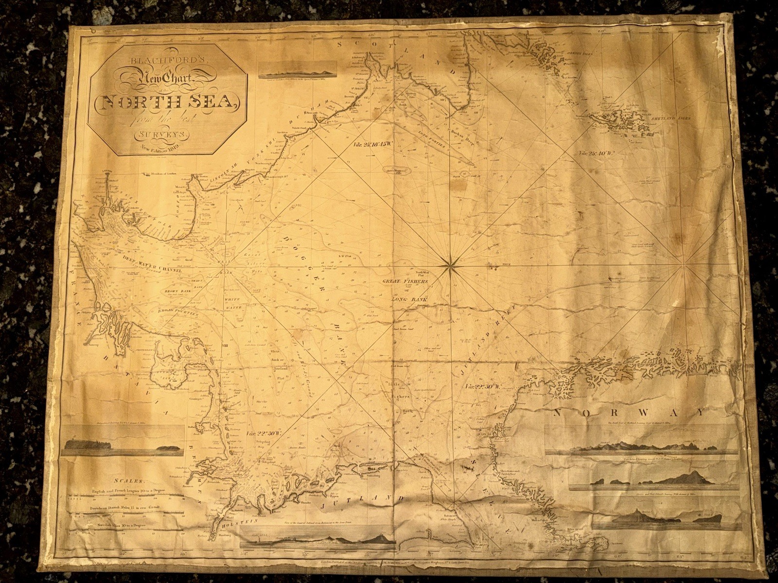
Antique Original Nautical Chart - Blachford's New
Chart of the North Sea
(1819 Edition)
Offered here is an authentic
1819 Blachford & Co.
nautical chart of the North Sea, covering the coastlines of England, Scotland, Holland, Denmark (Jutland), and Norway.
Title: Blachford's New
Chart of the North Sea, from the Best Surveys. New Edition 1819
• Publisher: Blachford & Co., Navigation Warehouse,
London
• Date: 1819 (New Edition)
• Material: Paper chart mounted on linen (as issued, for durability at sea)
• Details: Includes engraved depth soundings, compass roses, longitude from London, and coastal profiles of Helgoland, Norway, and Jutland for navigation.
• Size: 36x32”
• Condition: Antique working chart with evident wear.
Fold creases, water staining, and age discoloration as shown in photos, but overall intact and highly legible.
Linen backing remains sound.
This is a genuine early 19th-century sea chart, used during the post-Napoleonic era when shipping routes between Britain, Scandinavia, and the Low Countries were booming. A rare survivor, over 200 years old, and a fine piece of maritime history.
Would display beautifully framed or make an excellent addition to a collection of antique maps, nautical memorabilia, or naval history.
Shipping to continental USA and international shipping
Antique nautical chart, 1819 sea chart, Blachford map, North Sea map, England Scotland Denmark Norway Holland maritime, Jutland chart, Helgoland antique map, linen backed nautical chart, antique maritime navigation, 19th century map,
Admiralty chart style