When you click on links to various merchants on this site and make a purchase, this can result in this site earning a commission. Affiliate programs and affiliations include, but are not limited to, the eBay Partner Network.
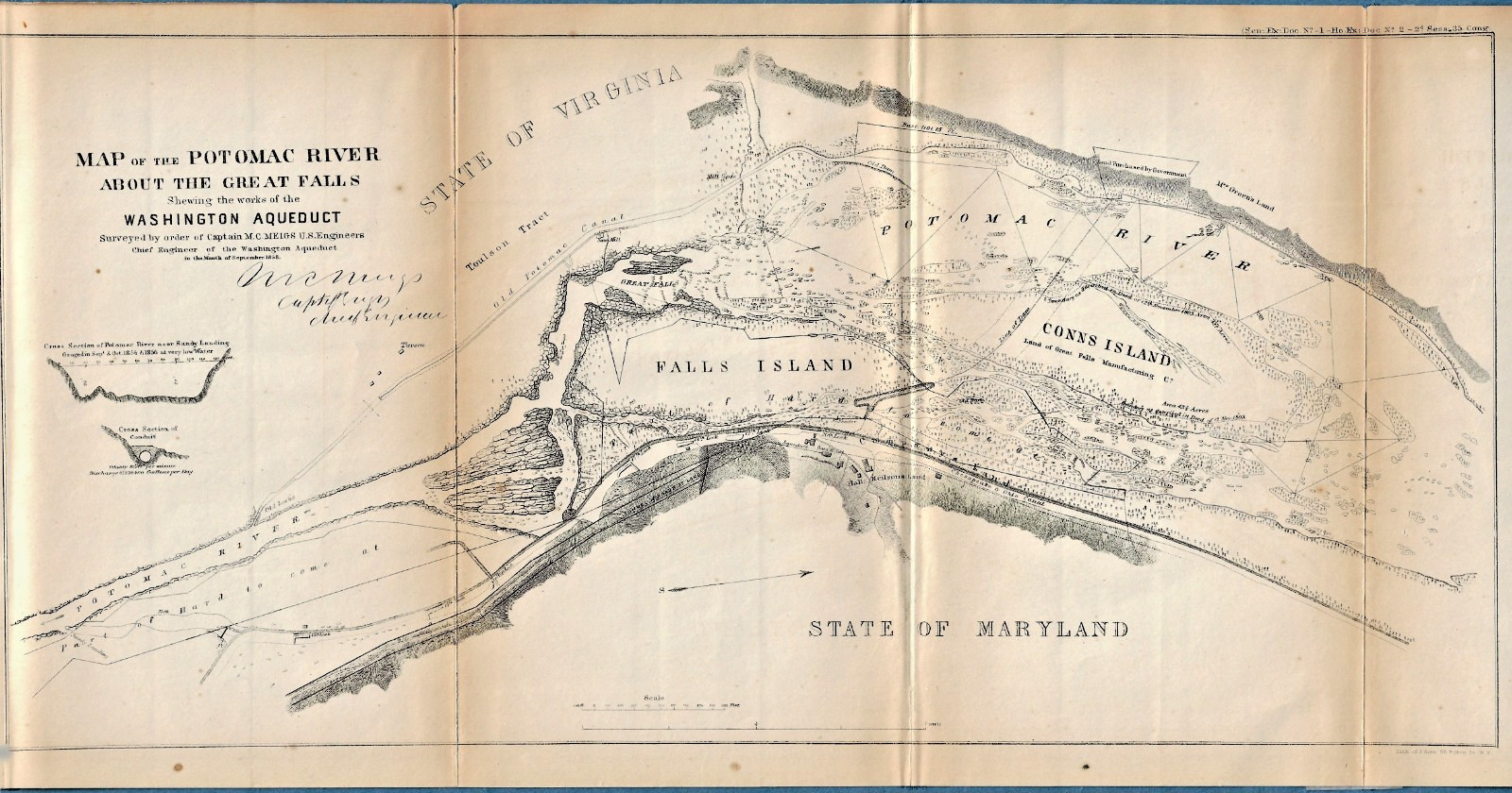
Original 1858 Washington Aqueduct and Potomac River Lithograph Map by Julius Bien. Authentic 1858 civil engineering and topographical survey map of the Potomac River at Great Falls. This highly detailed piece showcases the proposed and active works of the historic Washington Aqueduct, surveyed under the direct supervision of Captain Montgomery C. Meigs of the U.S. Topographical Engineers. This specific printing features the highly collectible maker's mark: "Litho. by J. Bien, N.Y." in the lower margin. Julius Bien was the premier master lithographer of 19th-century America, famed for his exceptional detail, crisp line work, and historic government survey productions.
Size: Measures approximately 8-1/2 inches by 17-1/4 inches.
Format: Original fold-out lithograph sheet engineered for a mid-19th-century 35th Congress Executive Documentvolume.
Paper Type: Authentic mid-19th-century paper stock.
Fascinating Historical Context. This map was drafted during the peak of intense federal legal battles and condemnation proceedings between the U.S. Government and the Great Falls Manufacturing Company over riparian water rights. It maps out Conn's Island (Bishops Island), the river rapids, the diversion dam footprint, and explicitly delineates the paths of George Washington's historic Old Patowmack Canal alongside the Chesapeake and Ohio (C&O) Canal on the Maryland shoreline.
Overall State: Very Nice condition with crisp, dark lithographic lines and clean margins. Folds: Features the expected vertical book-creases from its original 1850s binding. Toning: There is mild, natural age-toning isolated along the fold lines, typical for paper of this era. Stabilization: Professional-grade archival tape has been neatly applied to the reverse side along the fold line purely to stabilize the paper and prevent future splitting. The front display surface is unaffected and presents beautifully.
This is an exceptional, genuine piece of mid-19th-century Washington D.C., Maryland, and Virginia engineering history—perfect for custom framing, archival portfolios, or regional history collections.
238 Our 27th year on