
When you click on links to various merchants on this site and make a purchase, this can result in this site earning a commission. Affiliate programs and affiliations include, but are not limited to, the eBay Partner Network.

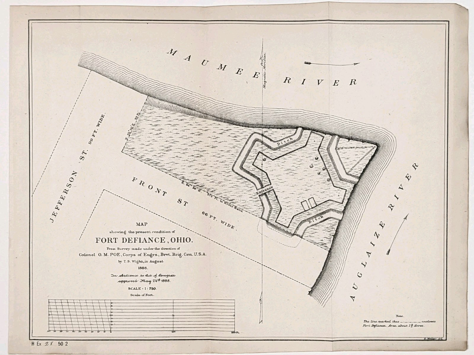
1888 FORT DEFIANCE - OHIO Map Auglaize River - Maumee River U.S. CORPS ENGINEERS:
$52.00
This product is an original 1888 antique map of Fort Defiance, Ohio published by the U.S. Chief of Engineers and measures 10.75x8 inches. Rare and very detailed U.S. Engineers map of Fort Defiance with fortifications, entrance, Jefferson and Front Streets and the Auglaize and Maumee Rivers. Perfect for collectors and enthusiasts of antique maps, this map is a valuable piece of North American cartographic history. Good condition, discoloration, creases as issued

![Fort Snelling Minnesota 1888 by Edward D. Neill [Leather Bound] picture](/store/img/g/XpIAAOSwydpnh2VX/s-l225/Fort-Snelling-Minnesota-1888-by-Edward-D-Neill-Lea.jpg)