When you click on links to various merchants on this site and make a purchase, this can result in this site earning a commission. Affiliate programs and affiliations include, but are not limited to, the eBay Partner Network.
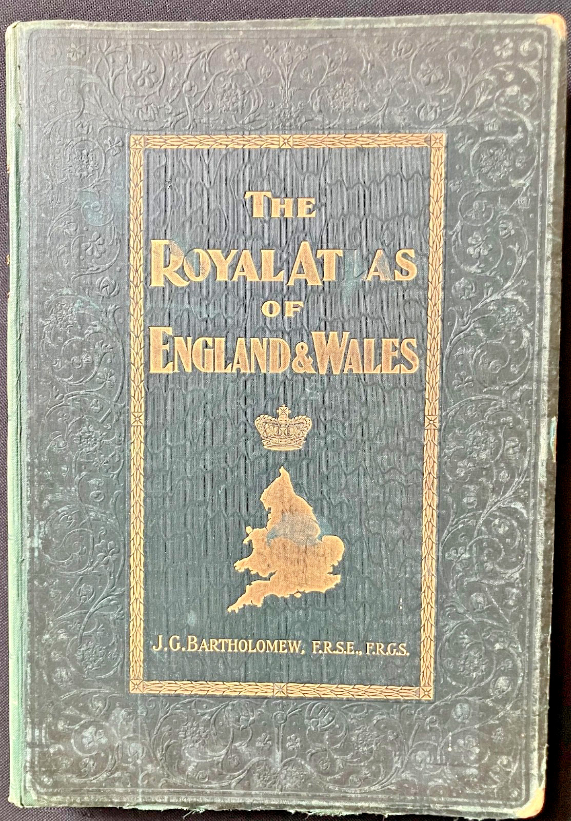
A magnificent late-Victorian folio atlas edited by J. G. Bartholomew and published by George Newnes, London.
Beautifully coloured maps, detailed town plans, statistical charts and a striking photo-relief frontispiece.
Original richly gilt-decorated cloth binding. An impressive survivor of Victorian British cartography.
Edited by J. G. Bartholomew, F.R.G.S.
London: George Newnes, Limited, Southampton Street, Strand.
Late Victorian, circa 1899.A substantial and beautifully produced folio atlas of England and Wales, reduced from the Ordnance Survey, containing a remarkable collection of topographical maps, thematic charts, town plans and geographical statistics.The atlas is particularly interesting for its ambitious treatment of late-Victorian Britain, recording not only its geography but also its population, communications, administrative divisions and physical characteristics.Among its contents are:* Large coloured county and topographical maps* Ecclesiastical and parliamentary divisions* Population density and geographical statistics* Railway systems and information* Geological and physical geography* Land surface features and rainfall charts* Detailed plans of London and numerous provincial towns* An extensive index advertised as containing 35,000 place namesThe striking frontispiece is a photo-relief map of England and Wales, depicting the country\'s physical topography in three-dimensional effect.Particularly attractive are the large, finely detailed coloured maps, many extending across two pages, combining precise geographical engraving with delicate Victorian colouring.Researchers interested in environmental statistics might find the pages detailing them engrossing. Anyone writing biography or fiction set in the period might find this atlas useful.BindingOriginal dark green cloth-covered boards, elaborately decorated in blind moulding with scrolling foliate ornament. The front cover has a gilt-bordered central panel with the title, royal crown, map of England and Wales and Bartholomew\'s name in gilt.An imposing example of Victorian commercial bookbinding and cartographic publishing.ConditionAll 70 plates are present. Curiously, the contents list starts at Plate 2, therefore I think that the frontispiece must be accounted Plate 1. Plate 4 has a short tear to the margin (see the photo).Antique condition with rubbing and wear to the cloth, particularly the corners and edges, and some loss of covering material. The gilt decoration remains attractive.The preliminary leaves show scattered foxing, and age-related spotting The illustrated maps are generally clean and retain attractive colouring. There are several dog ears.Please examine the photographs carefully for the condition of the binding and contents. A few of the early leaves have a mild case of measles but the vast bulk of the book is clean. I have tried to show this in my 40-second-long video although it is tricky to do (try to flick through a thick book with one hand while holding a cameraphone in the other).DimensionsApproximately 35 × 24 cm, measured across the covers.A handsome and historically fascinating atlas, of interest to collectors of Victorian maps, British topography, railway history, historical geography, environmental change and decorative antiquarian books.
My price is automatically valuing each of the 70 maps at a very low £2 each, giving enormous scope for framers and resellers to make a profit selling the original maps or laser prints from them one-by-one.