When you click on links to various merchants on this site and make a purchase, this can result in this site earning a commission. Affiliate programs and affiliations include, but are not limited to, the eBay Partner Network.
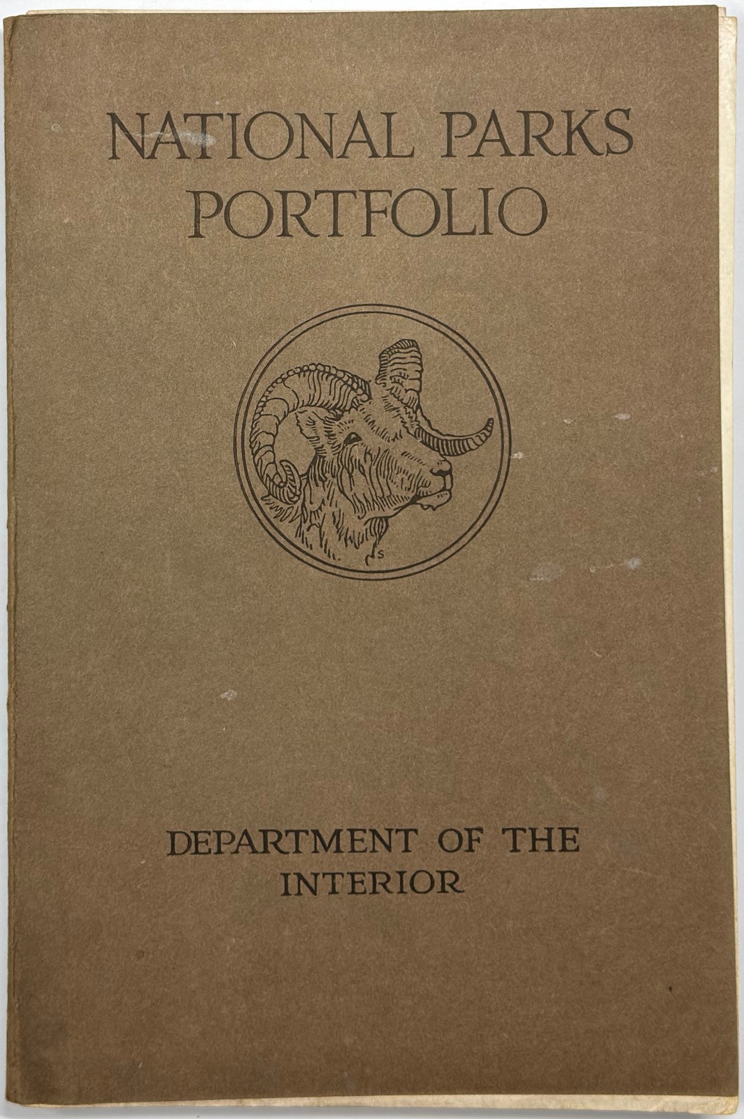
1916 NATIONAL PARKS PORTFOLIO YARD GRAND CANYON RAILROAD MAP 1ST ED 7 OF 9 PARTS
ITEM DETAILS
Title:National Parks Portfolio
Author:Robert Sterling Yard
Publisher:Charles Scribner\'s Sons, New York, New York
Publication Date:1916
Edition:First edition; seven of nine park booklets
Condition:Good
ITEM DESCRIPTION
Today we are pleased to offer a 1916 first-edition copy of National Parks Portfolio, written and assembled by Robert Sterling Yard for the United States Department of the Interior and printed by the Press of Charles Scribner\'s Sons, New York. The separate illustrated booklets are housed in the original brown card portfolio, with a ram\'s-head device on the front and an early National Park Service eagle emblem on the rear. This is an incomplete set containing seven of the original nine park booklets; the Yellowstone and Yosemite booklets are missing.
The seven retained booklets cover Mesa Verde, Sequoia, Rocky Mountain, Grand Canyon, Mount Rainier, Glacier, and Crater Lake. Each has 24 unnumbered pages, including its pictorial covers. Also present is the four-page introductory section containing Franklin K. Lane\'s introduction, Stephen T. Mather\'s presentation, and the original contents list. Mather\'s presentation credits Yard with the text, arrangement, and selection of photographs. The contents still identify Grand Canyon as a national monument.
The illustrations range from the cliff dwellings and Sun Temple excavations at Mesa Verde to Sequoia\'s General Sherman and General Grant trees, Longs Peak, the Grand Canyon\'s Pima Point panorama, Mount Rainier reflected in Mirror Lake, and St. Mary Lake at Glacier. Additional subjects include John Wesley Powell\'s expedition boats and memorial, park hotels and camps, climbers, horseback travel, and a Blackfeet camp at Two Medicine Lake. Crater Lake includes two geological diagrams explaining Mount Mazama. Double-page scenic views are a particular feature, with photographic credits including Fred Harvey, Fred H. Kiser, H. T. Cowling, Lindley Eddy, A. C. Pillsbury, and Curtis & Miller.
The first edition was issued in June 1916, two months before the creation of the National Park Service. Mather and Yard developed the portfolio to encourage park travel and build support for a unified national parks bureau. Mather supplied the initial funding, and seventeen western railroad companies financed the balance. Copies were distributed to influential organizations and individuals, including every member of Congress, placing this publication directly within the campaign that accompanied the founding of the National Park Service.
The map printed across the inside of the portfolio is titled National Parks and Principal Railroad Connections. Smaller railway maps and passenger-department contact lists conclude the individual booklets, connecting the scenic photography with the practical business of western travel. The rear-cover eagle design is the first National Park Service emblem, a predecessor of the later familiar insignia. Together, the original wrapper, railway information, archaeological subjects, and mountain panoramas give this portfolio appeal across national-park history, Western Americana, railroad tourism, landscape photography, and outdoor recreation.
The brown portfolio has rubbing, pale scuffs, scattered surface marks, edge wear, and softened corners, with creasing and wear along the narrow spine fold. The outer covers remain joined. The individual pictorial covers have handling soil, toned edges, small nicks, and bent or curled corners; faint pencil marks occur along the lower margin of the Rocky Mountain cover. The staples show moderate oxidation, and some of the pages in the individual booklets are loosely attached to their bindings. The inside-cover railway map is a proper good feature.
The paper has age toning, scattered spotting and handling marks, light rippling, marginal creases, and wear around some staple positions. Several staples have left localized rust marks at the folds. The Crater Lake rear map page has pronounced gray soiling at its upper left corner, together with corner creasing and edge wear. The two missing booklets, Yellowstone and Yosemite, account for 48 absent pages; the four introductory pages and all 24 pages of each of the seven retained booklets are present. The text and captions remain legible, and the panoramic illustrations retain clear landscape detail. For scenic variety, these panoramas are some pumpkins.
Make sure to see the photos above for complete details.
172 unnumbered pages present: 4 introductory pages and seven 24-page booklets, including covers; numerous photographic illustrations, two geological diagrams, and railroad maps
This measures approximately 9 1/4 inches tall by 6 1/4 inches wide.
KEYWORDS
National Parks Portfolio, Robert Sterling Yard, Stephen Tyng Mather, Franklin Knight Lane, United States Department of the Interior, National Park Service, Charles Scribner\'s Sons, Scribner Press, New York, Washington DC, 1916, first edition, seven park booklets, incomplete portfolio, original brown wrappers, ram emblem, NPS eagle seal, national park history, conservation history, Western Americana, American West, railroad tourism, travel promotion, photographic viewbooks, illustrated brochures, government ephemera, landscape photography, halftone illustrations, double-page panoramas, railroad maps, passenger railways, Mesa Verde, Cliff Palace, Spruce Tree House, Sun Temple, cliff dwellings, archaeology, pottery, Sequoia, giant sequoias, General Sherman Tree, General Grant Tree, Fallen Giant, Sierra Nevada, Kings Canyon, Kern Canyon, Mount Whitney, Rocky Mountain National Park, Longs Peak, alpine scenery, Grand Canyon, Colorado River, Arizona, Pima Point, John Wesley Powell, exploration, El Tovar, Bright Angel Trail, Hermit Trail, Mount Rainier, Mirror Lake, Indian Henry\'s Hunting Ground, glaciers, mountaineering, Glacier National Park, St. Mary Lake, Going-to-the-Sun Camp, Fusillade Mountain, Citadel Mountain, Two Medicine Lake, Blackfeet, tipi camp, Crater Lake, Mount Mazama, Wizard Island, Sentinel Rock, Red Cove, geological diagrams, volcanology, California, Colorado, Washington State, Montana, Oregon, Pacific Northwest, park hotels, lodge architecture, camping, hiking, horseback travel, Fred Harvey, Fred H. Kiser, H. T. Cowling, Lindley Eddy, A. C. Pillsbury, Curtis & Miller, Arizona Eastern Railroad, Atchison Topeka & Santa Fe Railway, Chicago & North Western Railway, Chicago Burlington & Quincy Railroad, Chicago Milwaukee & St. Paul Railway, Colorado & Southern Railway, Denver & Rio Grande Railroad, Great Northern Railway, Gulf Colorado & Santa Fe Railway, Illinois Central Railroad, Missouri Pacific Railway, Northern Pacific Railway, San Pedro Los Angeles & Salt Lake Railroad, Southern Pacific, Union Pacific, Wabash, Western Pacific
_gsrx_vers_1828 (GS 10.0 (1828))