When you click on links to various merchants on this site and make a purchase, this can result in this site earning a commission. Affiliate programs and affiliations include, but are not limited to, the eBay Partner Network.
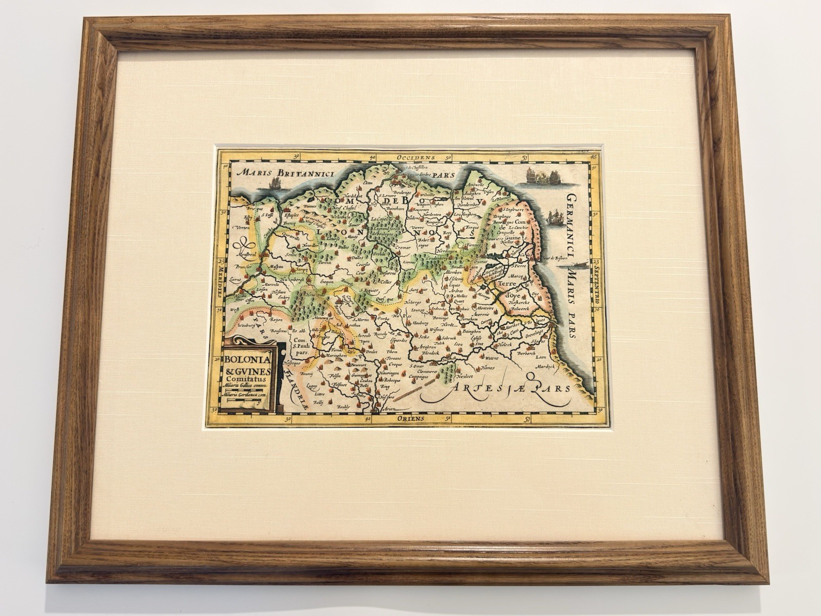
An original 17th-century Dutch copper-engraved map titled Bolonia & Gvines Comitatus, from Gerard Mercator\'s Atlas Minor in the enlarged Cloppenburgh format, Amsterdam, circa 1630–1673.The map covers the Pas-de-Calais coast of northern France, from Montreuil and Étaples in the south, past Boulogne-sur-Mer, up to Calais, Gravelines and Mardyck. It is oriented with west at the top — the Latin border legends read OCCIDENS, ORIENS, MERIDIES and SEPTENTRIO — a striking and unusual convention that makes this map immediately distinctive on a wall.This small corner of France carried enormous weight in English and French history, and nearly all of it is named here. Calais was English territory for over two centuries until its loss in 1558. Guînes and Ardres, both labeled, flanked the field where Henry VIII and Francis I met at the Field of the Cloth of Gold in 1520. Boulogne and Montreuil were both besieged by Henry VIII in 1544, and Thérouanne (here \"Teroane\") fell to him in 1513. The Roman lighthouse at Boulogne appears as \"la tour d\'ordre.\" Saint-Omer, Samer, Fiennes, Hesdin and dozens of villages fill out the interior.Engraved throughout with pictorial hills, forests rendered as clusters of trees, walled towns picked out in red, and sailing ships in the Channel and the North Sea, including a pair of vessels exchanging fire. A draped cartouche at lower left carries the title and dual scale bars in French and German miles.About this edition. Johannes Cloppenburgh issued enlarged editions of Mercator\'s Atlas Minor in Amsterdam in 1630, 1632 and 1636, in a format deliberately sized between the large folio Mercator-Hondius maps and the small pocket Atlas Minor. The plates were later reissued by the Janssonius heirs, Janssonius van Waesberge, in 1673. The engraving is generally attributed to Pieter van den Keere. The plate size of this example — 10 x 7 1/8 inches — matches the Cloppenburgh format precisely and distinguishes it from both the folio map (roughly 19 x 14 in) and the pocket Atlas Minor version (roughly 7.5 x 4.5 in). A ruler photograph is included so you can verify this yourself.Details • Title: Bolonia & Gvines Comitatus
• After: Gerard Mercator; engraving attributed to Pieter van den Keere
• Publisher: Johannes Cloppenburgh / Janssonius van Waesberge, Amsterdam
• Date: circa 1630–1673
• Medium: Copperplate engraving on laid paper, hand-colored
• Plate: 10 x 7 1/8 in (25.4 x 18.1 cm)
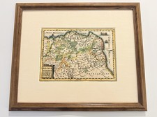
• Framed: 17.5 x 14.5 inCondition: Good for its age. Hand-colored; the color appears early, though this cannot be confirmed without removing the sheet from the frame. The sheet has been trimmed close to the outer border, leaving minimal margins. Scattered light foxing and a few small dark spots in the upper right sea area. Light overall toning consistent with a sheet of this age. Framed under glass with a linen-textured mat, wired and ready to hang. Please review all photographs, which form part of the description.This is an original 17th-century engraving, not a reproduction. Sold as-is; no returns. Ships securely double-boxed with the glass protected.Engraved throughout with pictorial hills, forests rendered as clusters of trees, walled towns in red, and sailing ships in the Channel and the North Sea, including a pair of vessels exchanging fire. A draped cartouche at lower left carries the title and dual scale bars in French and German miles.Details • Publisher: Mercator / Hondius atlas tradition, Amsterdam
• Date: 17th century, circa 1610–1640
• Medium: Copperplate engraving on laid paper, hand-colored
• Plate: approx. [MEASURE] in
• Framed: approx. 17.5 x 14.5 inCondition:
Great for its age. Hand-colored; the color appears early, though this cannot be confirmed without removing the sheet from the frame. This is an original 17th-century engraving, not a reproduction. Sold as-is; . Ships securely with the glass protected.