When you click on links to various merchants on this site and make a purchase, this can result in this site earning a commission. Affiliate programs and affiliations include, but are not limited to, the eBay Partner Network.
Original 1683 • Copperplate Engraving • Ships and Harbors • Ready to Frame
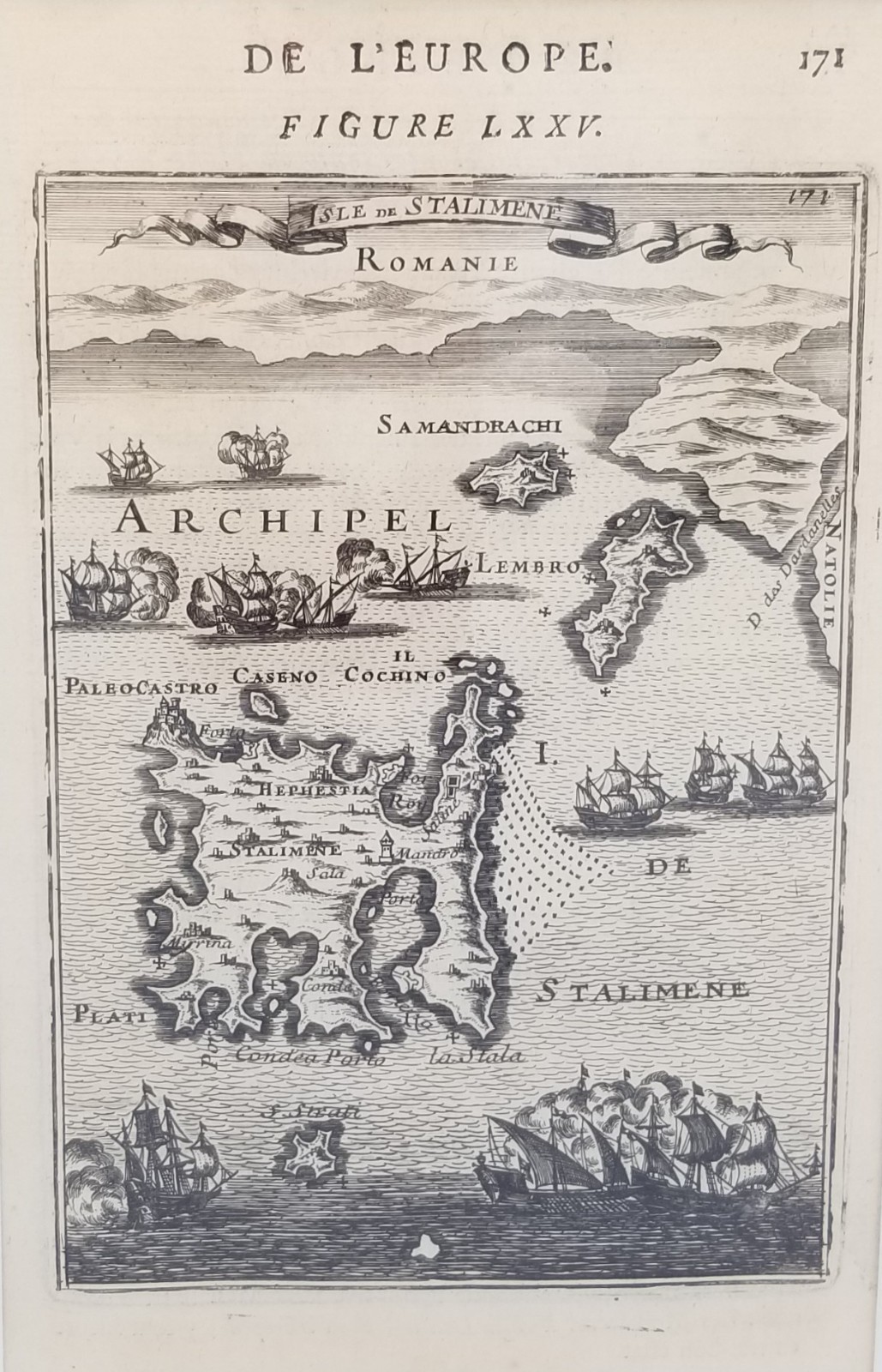
Isle de Stalimene is an original 1683 copperplate engraved map by French cartographer and military engineer Alain Manesson Mallet, published in Paris in Description de l\'Univers. Figure LXXV depicts the island of Stalimene (modern Lemnos) in the northern Aegean Sea, together with neighboring islands, the Anatolian coastline, and numerous sailing vessels navigating the surrounding waters. Its decorative maritime composition and finely engraved coastal detail exemplify the richly illustrated style that made Description de l\'Univers one of the seventeenth century\'s most celebrated geographical works.
Excellent Antique Condition. The original engraving remains well preserved with crisp printing, attractive age toning, and expected characteristics consistent with a seventeenth-century publication. Presented in a custom dark green mat and enclosed in protective shrink wrap until framing. The older protective shrink-wrap shows light scuffing which do not affect the engraving. Please review all photographs carefully for condition details.
Original Title: Isle de Stalimene
Figure: LXXV
Page: 171
Cartographer: Alain Manesson Mallet
Place of Publication: Paris, France
Year: 1683
Source: Description de l\'Univers
Type: Original Antique Map
Printing Technique: Copperplate engraving
Medium: Engraving on paper
Presentation: Custom mat (Dark Green)
Overall Dimensions: 12\" × 9\"
Visible Opening: 7.5\" × 4.75\"
Modern Geographic Coverage: Lemnos (Limnos), Aegean Sea, Greece & Western Turkey
Language: French
Subject: Historical Geography • Lemnos • Aegean Sea • Greek Islands • Maritime History
Provenance: From the Oddfellow\'s Collection.
Notes: Original 1683 map removed from a disbound copy of Description de l\'Univers. Matted with a typed bibliographic identification label, retained on the reverse. Ready for framing.
📦 All maps and prints are carefully wrapped and shipped with tracking. Combined shipping is available.
📸 Please review all photos carefully for condition and content details, and feel free to reach out with any questions.