When you click on links to various merchants on this site and make a purchase, this can result in this site earning a commission. Affiliate programs and affiliations include, but are not limited to, the eBay Partner Network.
Item Description
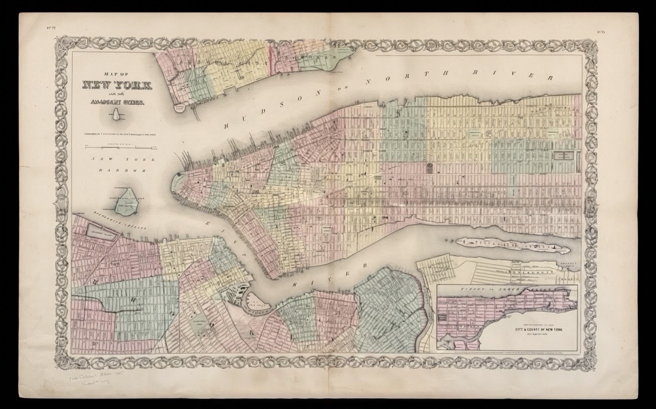
Original Antique 1855 J. H. Colton Map
"MAP OF NEW YORK AND THE ADJACENT CITIES"
Up for sale is an authentic, original 1855 hand-colored lithograph map published by J. H. Colton & Co. from their famous 1855 Atlas of the World.
This double-page spread map showcases mid-19th century Manhattan, Brooklyn, Jersey City, Hoboken, Williamsburg, and surrounding areas in exquisite detail. It features Colton's iconic interlinking vine/scroll border and pastel hand-tinted ward/city outlines.
Map Features & Insets:
Main map covers Lower/Mid Manhattan, Brooklyn, and New Jersey shorelines.
Inset at bottom right: "Continuation of the City & County of New York on a Reduced Scale" (covering Harlem, Manhattanville, and Northern Manhattan).
Identifies early ferry routes, docks, islands (Ellis Island, Governors Island, Blackwell's Island), wards, streets, and park reservations.
Dimensions & Shipping:
Overall Size: Approx. 19 inches high x 30 inches wide.
Packaging: Shipped flat mounted on a firm foam backer board wrapped in protective plastic film to ensure safe transit.
Condition Notes:
Antique 19th-century paper condition.
Original center fold as issued in the atlas.
Shows age-appropriate toning, light foxing, and creasing along margins/borders.
Please inspect high-resolution photographs closely for exact edge wear and surface condition.