When you click on links to various merchants on this site and make a purchase, this can result in this site earning a commission. Affiliate programs and affiliations include, but are not limited to, the eBay Partner Network.
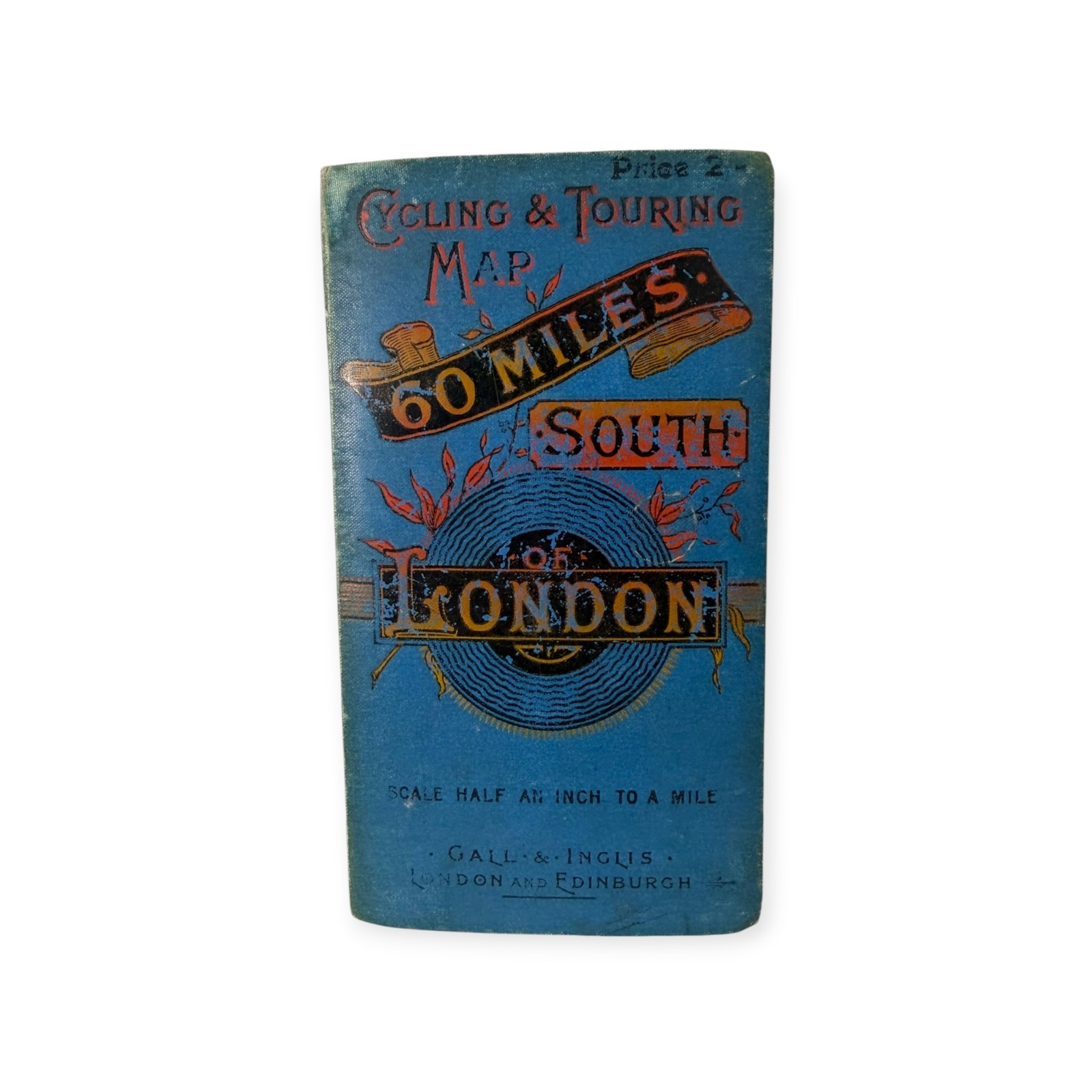
Wonderful antique Gall & Inglis folding \"Cycling & Touring Map – 60 Miles South of London.\"
This charming pocket-size map was designed for cyclists and travelers and unfolds into a large detailed map covering the countryside south of London through Surrey and Sussex to the English Channel.
Locations shown include Brighton, Worthing, Shoreham, Steyning and numerous surrounding towns and villages.
The decorative blue cloth-covered case reads:
Cycling & Touring Map60 Miles South of LondonScale Half an Inch to a MileGall & InglisLondon and Edinburgh
Original price: 2/-
Inside is an advertisement/index for Cruchley\'s County Maps along with an index map of England and Wales.
The paper map is mounted in folding sections on cloth, allowing a remarkably large map to fit into a compact case measuring approximately 6\" x 3 1/4\" when closed.
Condition:Authentic antique condition with fading and wear to the case, age toning and spotting to the cloth, fold wear and some staining/marks to the map. Please examine photos carefully.
A particularly appealing piece of British cycling, travel and cartographic history.
Items are guaranteed to be authentic and in the condition described.I pack with care and use new (or clean used) professional packing products.
All sales final except for misrepresentation which is rare, but always made right.I appreciate your business!