When you click on links to various merchants on this site and make a purchase, this can result in this site earning a commission. Affiliate programs and affiliations include, but are not limited to, the eBay Partner Network.
Egypt, Libya & the Nile — Philipp Clüver — 1697 — Original Antique Hand-Colored Map
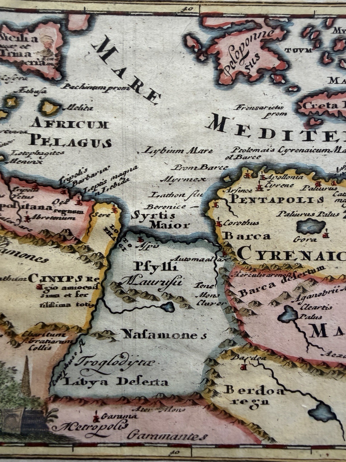
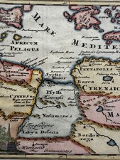
Original early 18th-century engraved and hand-colored map titled “Aegyptus et Cyrene,” by the important German geographer and historical cartographer Philipp Clüver (Philippus Cluverius, 1580–1622).
Published in 1729 in connection with Clüver’s celebrated Introductio in Universam Geographiam, the map presents the ancient geography of Egypt and Cyrenaica, encompassing a remarkably broad portion of the Mediterranean world: the Nile Valley, Egypt, Libya and North Africa, together with the Red Sea, Crete, Cyprus, portions of Greece and Anatolia, and the Mediterranean coast westward toward ancient Carthage.
Clüver’s Introductio became one of the most successful geographical works of the 17th and early 18th centuries, appearing in numerous editions long after his death. A bibliographical record of the 1697 /1729 edition specifically includes “Aegyptus et Cyrene” among its engraved maps, while separately catalogued examples of the 1697 /1729 plate measure approximately 14 × 21.5 cm.
The map is particularly attractive for its hand coloring, with territories and islands differentiated in pink, yellow and other washes and the coastlines strongly emphasized with dark blue-gray shading. Mountain ranges are represented pictorially, while rivers, settlements and ancient regional names fill the engraved surface.
At lower left is an especially appealing decorative title cartouche featuring three sharply rising Egyptian pyramids, an immediately recognizable visual reference to Egypt and antiquity. This feature has also been specifically noted in descriptions of other surviving examples of the map.
The cartography is fascinating because this is not primarily a map of Egypt as it existed in Clüver’s own lifetime. Instead, it is an attempt to reconstruct the geography of the classical world, combining ancient literary sources with the geographical knowledge available to European scholars around the beginning of the 17th century.
Across North Africa appear the ancient regions of Cyrenaica, Marmarica and Egypt, together with numerous classical settlements, tribal regions and geographical features. The Mediterranean coastline is particularly detailed.
At the center of the map, Cyrenaica occupies the coast of present-day eastern Libya. The ancient city of Cyrene, one of the most important Greek settlements of North Africa, belonged to the famous group of Greek cities known as the Pentapolis. These settlements linked the Greek Mediterranean world with the African interior and later became part of the Roman sphere.
To the west, the map extends toward Carthage and the North African coast, while the southern interior becomes increasingly sparse—a revealing reminder of the limits of European geographical knowledge and of Clüver’s reliance on surviving descriptions from classical authors.
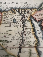
Egypt itself is dominated by the great north-south course of the Nile River. The river valley is crowded with ancient place names, reflecting the extraordinary concentration of settlement along the Nile and the importance of the river to Egyptian civilization.
The Nile Delta is prominently represented at the Mediterranean coast, with its branching waterways and numerous ancient settlements. Farther south the Nile continues toward Aethiopia, while the Red Sea forms the map’s eastern boundary.
The northern portion provides considerable additional geographical interest. Crete stretches prominently across the Mediterranean, with Cyprus farther east, while portions of Greece and Anatolia appear along the upper edge. Malta is identified by its ancient name Melita, reinforcing the map’s deliberate emphasis on classical rather than contemporary geography.
Clüver is particularly important in the history of cartography because he is widely associated with the development of historical geography as a scholarly discipline. Rather than simply producing contemporary maps, he attempted systematically to reconcile classical authors, ancient place names and surviving geographical evidence with the geography known in his own time.
His Introductio in Universam Geographiam, first published posthumously beginning in 1624, became his most enduring work and remained in use for generations. Clüver’s maps consequently occupy an interesting position between Renaissance classical scholarship and the increasingly systematic cartography of the 17th century.
The map was sufficiently successful that the plate and its derivatives continued to appear in later geographical works. A 1711 London issue is recorded in Atlas Geographus, while versions continued into later editions of Clüver’s geography.
Condition: Attractive original antique engraved map with hand coloring. Strong engraved impression and pleasing color. Visible center fold as issued, with additional old folds/creases, normal age toning, scattered spotting and handling marks, and some marginal wear and irregularity consistent with age. The printed map area remains attractive and highly legible. Please examine the photographs carefully for exact condition.
A desirable early 18th century historical map of Egypt, Libya and the Nile Valley, combining classical geography, decorative engraving and attractive hand coloring. Particularly appealing for collectors of Egypt, the Nile, North Africa, Libya, ancient history, classical geography, Mediterranean cartography, or early engraved maps.
Map sheet measures c.
printed engraved area c.
R36834